ok, here's the latest news I have:
The ATV/MC community has lost EVERYTHING for a good chunk of time. And by everything, I mean EVERYTHING. Shocked
In one 1/4 mile they lost either 3 or 6 bridges on the Tahuya River trail (IIRC). I can't recall if it was 3 or 6, but it was all of them, each of them built out of steel and 100' long. The riverbed is now 300' wide. One of their trails has over 100 down trees on it. I understand they have 200 some odd volunteers that have said they are willing to come out to help, but they have to figure out a plan first. It's a major mess, lets put it this way, when the DNR was surveying the damage the highlights were one relocated house that went down river and is now on a bank and a school bus (no one got hurt).
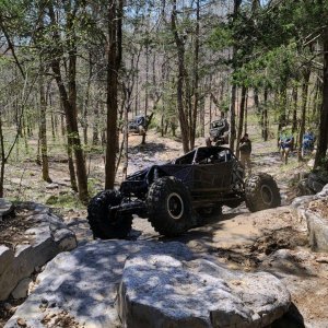
As such, the 4x4 system is getting closed down again to protect it from overuse and abuse. The plan was to open it, but with the staging areas closed the users out there already started staging at the trail head. Rolling Eyes They did get punted out of there though. Then the issue is with ATV and MC userbuilts popping up in the 4wd system to avoid all the water holes, or just flat out overuse. To understand that, imagine having all the users over 20,000 some odd acres squished in to 1200.
We are talking about what *could* be a 3-4 week closure until some of the ATV/MC trails can be re-opened. As much as that sucks, it could be a LOT worse, afterall, we can't all use the trails quiet yet, but they are largely ok and really have no work to do minus the culvert thing and re-opening broken axle. Certainly not enough to call a work party for 4x4 trail related reasons.
Even with it open, if you are caught off a designated trail or undoing or bypassing a closure, especially now. You'll not only face a guaranteed $134-500 ticket, but you stand a good chance of getting your rig impounded.
Lets get on to the better news.
1) It sounds promising that we may be able to sign off the 4x4 trail head as "4wd only, no ATV or MC" and get it back open very soon. I'm pushing to get it open again ASAP.
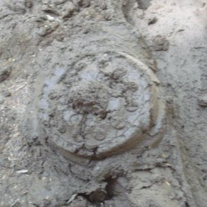
2) Broken Axle hill - I think we can keep it as is. I'll talk further with the DNR, but if we can work out some warning signage and a speed reducer, such as some logs across the trail a 4x4 can get over but an ATV or MC can't get over without working at it at the top of the hill. That may very well take care of their liability concerns. The crack you see in the pictures is about 3' deep and 1-2' wide.
3) The culvert - there's still 8" of water over it. So South Loop isn't a loop until the water recedes. I looked at it today and decided unblocking the pipes wasn't going to be happening until the water level came down. Honestly, it needs to be replaced, but being a class 3 stream it would need an EA (environmental assessment) and since we'd have to dig deeper than 2' another agency (forgot the name) gets involved. PAIN IN THE ASS - this is why it is so important to stay off it.
4) All that stands between spillman and it getting open again is some materials to rebuild a section of fence. Just have to find them. I might go for a walk down river next week and see if I can. Laughing
5) horse camp, there's some 80-100' really dangerous leaners that need to be delt with and that massive crater that you saw in the pictures. But even before that can really open, spillman road must be repaired.
I think that covered everything, but ask if there is something I missed.
I am just going to have to ask for everyone's patience in this. Think of it as an opportunity to do some long needed maintenance or repairs on your rig. Smile


